|
|
|
|
|
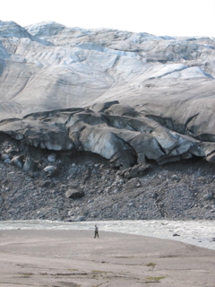
PAST Events & Workshops - RESULTS: Write-ups, Comments, and Photo Albums HERE 2020 The 2020 MAPSS - MAWS - MASE Soils and Natural Resource Field Workshop was held at Reid State Park in Georgetown, Maine on Wednesday, September 9th, 2020.
The Curriculum and types of sites for meeting attendees to inspect and make their determinations and
the Registration and information form can be downloaded. New this year will be the recent changes to WOTUS (Waters Of The United States) administered by
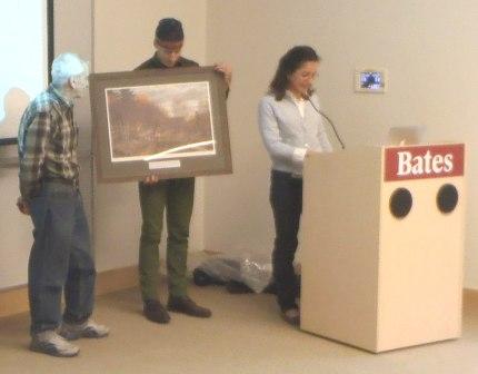
the ACOE and how this may impact stream and wetland determinations from last year. Continuing Forestry Education (CFE) credits for Category 1 CFE's for 6 hours were be granted by SAF. NRCS has exercised the ability to hire outside USDA to get more qualified soil scientists, which hasn’t happened much in the last decade. They are doing it now: Here is the Lay of the Land winter, 2020 newsletter. 2019 Here is the 2019 Piscataquis County Soil and Water Conservation District Annual Report. Munsell notation correction Xrite, successor company to Munsell, was contacted about a discrepancy between the 1994 and 2009 editions on the 2.5Y page. After some checking, the company acknowledged that a mistake had been made and that the color names for chips 2.5Y 7/3, 7/4, 8/2, 8/3, and 8/4 should in fact be pale yellow, not pale brown. It is not known when an official update of the 2.5Y page will be issued. Please make a pen and ink correction on the 2.5Y page to change “pale brown” to “pale yellow.” Here is the link to Version 4 of Field Indicators for Identifying Hydric Soils in New England. Additional links to the Version 4 Companion Guide, the Supplement 1 (Cheatsheet), and the Memo from USACOE on use of Version 4 for Chapter 5 situations. Executive Committee Meeting of Friday, November 22nd, 2019 was held at the Deering Agricultural building in Augusta. Meeting minutes are now uploaded to the Meeting Minutes directory. Here is the Lay of the Land summer, 2019 newsletter. The National Cooperative Soil Survey (NCSS) May, 2019 newsletter features an article on HSG determination by MAPSS Technical Committee Chair Tony Jenkins. Article begins on page 18 and the PDF can be downloaded here. Job Vacancy Posting - Wetland Scientist position open at Tetra Tech Link here to apply. Job Vacancy Posting - Cartographer for the DEPARTMENT OF INLAND FISHERIES & WILDLIFE Office located at 284 State Street 41 State House Station, Augusta, ME 04333 Link here to apply. Here is the Lay of the Land winter, 2019 newsletter. The MAPSS Ad Hoc Affiliation Committee revised meeting minutes from the February 4, 2019 meeting with SSSNNE are completed. For MAPSS members wishing to join the Society of Soil Scientists of Northern New England (SSSNNE), the membership form can be downloaded. A Stream Monitoring Internship is available through Friends of Acadia. Please link here to view the application. Replace your old Field Indicators Version 3 with the new updated Version 4.0 Link here 2018 Happy World Soils Day! Check to see what the Soil Science Division has posted on the NRCS Soils and World Soils Daypages. World Soil Day is on December 5th! Stay tuned each Wednesday the Soil Science Division is posting something new, until December 5th. If you would like to view the new and important information visit NRCS Soils and World Soils Day. In Portsmouth, NH a Poorly and Very Poorly Drained Soils Workshop is being held on October 26th! Click here for the info New Hampshire Association of Natural Resource Scientists. HANDOUTS from MAPSS soils workshop held at the University of Maine, Orono forestry center. Click here for The NRCS National Engineering Handbook Chapter 7 and click here for the soil and site worksheet. Click here for The Site Specific Soil Mapping PowerPoint. September 5th, 2018 MAPSS soils workshop from 8:00 am to 4:00 pm at the University of Maine, Orono forestry center. Excavator dug soil pits to be examined by participants in order to develop a Connotative Soil Survey, or "HISS" style of mapping. How to assign Hydrologic Soil Groups (HSGs). State Soil Scientist Tony Jenkins and Chris Dorion to moderate. Afternoon to feature a presentation by State Soil Scientist Tony Jenkins on "Soil Survey Work Planning Session" for soil related projects in Maine. Click here for directions and click here for the registration information. MAWS Annual Meeting & Winter Conference will be held March 22nd, Starting times include: Registration at 7:45am, the Conference at 8:30am, and the Annual Meeting at 3:30pm. 2018 Soil Matters Conference will be held on April 4th at the Audubon Center in Concord, NH. To view click here. The 2018 Winter Newsletter is now available, to view click here. Don't forget to sign up and mail your checks out for the 2018 Annual Meeting at Unity College on March 7th, registration can be downloaded here. The Agenda has also been Updated and is available here. The 2018 Annual Meeting is set for Unity College on March 7, 2018. To Register click here. The 2017 annual treasury report is available here. Happy World Soil Day! The Global Soil Partnership (GSP) is celebrating today to the theme "Caring for the Planet starts from the Ground". More information click here. State of Maine Agricultural Trades Show, Jan. 9-11, 2018, Augusta. More information click here. 2017 SSSNNE 2017 Fall Meeting will be held Friday December 8th, at the Great Bay Discovery Center located at 89 Depot Road in Greenland, NH. Meeting topics include SSSNNE's Publication of Hydric Soils Version 4 updates, harmonization impacts to Publication #5, AoT Rules and Web Soil Survey Meeting Agenda and Registration can be found here. Maine Soil Health Workshop, Dec. 5, 2017, Waterville. Speakers include Extension educators, crop advisors, and farmers, who will discuss their research and experiences with soil health strategies on dairy and vegetable farms. Cost (includes lunch): $20 if registered by Wednesday, Nov. 29; otherwise $25. More information and registration click here. MAPSS 2017 Fall Workshop Handouts part #1 are available here and the Handouts part #2 are available here. MAPSS 2017 Newsletter is available here dont forget to sign up for our Fall Workshop on September 6th! MAPSS Workshop has been shceduled for September 6th in Searsmont, ME. Registration, Location and Agenda can be found here. Maine Association of Wetland Scientists is hosting a Wetland Mitigation Workshop Friday, August 11, 2017 8:00AM – 12:30PM at the University of Maine Memorial Union Bumps Room, Orono, Maine. Registration details can be downloaded here. The New England Hydric Soil Technical Committee's Field Indicators for Identifying Hydric Soils in New England Version 4, May 2017 is now available for review and download here. MAPSS next field workshop has been shceduled for September 6th in Searsmont, ME. Registration, Location and Agenda to be posted shortly. MAPSS Annual meeting has been reshceduled for Wednesday, March 29. See you all there. MAPSS Annual meeting has CANCLED due to the storm! Further details of a new time will be posted shortly. The Society of Soil Science of Northern New England (SSSNNE) is hosting a Soils Matters Conference and is occuring April 18th at the NH Audubon, Silk Farm Rd., Concord, NH. The deadline to sign up is April 7th. The registration form and agenda is now available here. The Maine Association of Wetland Scientists (MAWS) Winter Confrence & Annual Meeting is occuring Thursday, March 23rd at Bowdoin College. The deadline to sign up is Friday, March 13th. The newsletter, registration form and agenda is now available. The registration and agenda is available here. The newsletter is available here. The winter newsletter and the registration form is now available. The meeting agenda is in the newsletter. The deadline to sign up is Friday, March 10th. This will ensure that you are guaranteed a meal. The registration is available here. The newsletter and agenda is available here. Participate in the FREE 2017 Science and Technology Conservation Webinars presented by the USDA NRCS its open to the public and CEU's are available after completion of the training. Click here to schedule your desired webinars. MAPSS 2017 Annual Meeting on March 15th is scheduled at the Wells Common Meeting Center at the University of Maine in Orono. Registration and Agenda to be posted shortly. 2016 SSSNNE is hosting an upcoming Hydric Soils Workshop in Concord, New Hampshire on October 28th 2016 co-sponsored with the NH Association of Natural Scientists. You can refer to the flyer by clicking here. Please spread the word. A photo of Dave Rocque accepting his award at our annual meeting on Thursday, March 24th, 2016 at Bates College, in Lewiston.
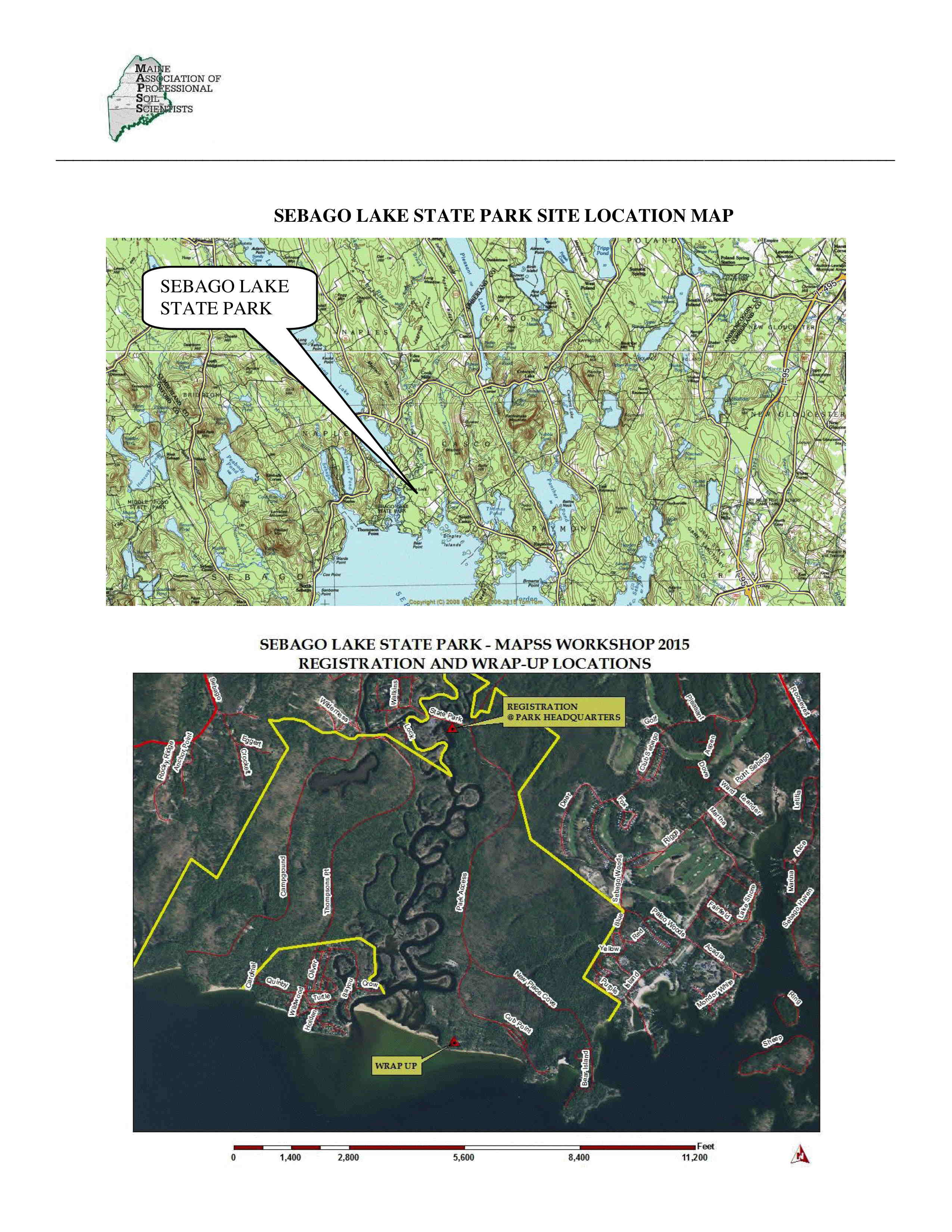
The Sebago Lake State Park Soils and Natural Resources Workshop is to be held on Wednesday, September 7, 2016. Where else would you want to be in September after all the tourists head home for the winter but on beautiful Sebago Lake. Last year we had great weather – sunny and in the 80’s. Let’s hope for the same again. If you missed it last year, you don’t want to miss this one. If you came last year, there will be a few things different this year. I’ve heard there will be at least one station with the wetland delineated in the field. We hope to see you all there. The accompanying location map for the workshop can be downloaded here. The registration is available here. The description and Agenda is available here. Common Ground Fair is scheduled on September 23, 24, and 26th! Please don't miss out on the soil trench that will be on display.
Multidecadal Response in Soil C, N, and Hg to the 1947 Mt. Desert Island Fire Using Paired Watersheds in Acadia National Park, Maine presented by University of Maine Master's Student Michael Jakubowski is available here. Why Improving Soil Heath is Good for Your Soil & Your Business: A 30+ Year Perspective presented by Chris Bales, Casella Organics, Portland and Unity, ME is available here. The Future Of Soil Mapping Using LIDAR Technology presented by Jessica Philippe; NRCS Saint Johnsbury, Vermont, Soil Survey Office is available here. An Overview of Recent NRCS Changes in the Classification and Description Standards when Describing Urban Soils presented by Nick Butler; USDA-NRCS 12-DFX Soil Scientist is available here. The Winter Edition Of The Lay Of The Land has recently been updated and is available here. MAWS is hosting a Bat Workshop with the Regulators on March 09, 2016 at the Viles Arboretum in Augusta, from 8 AM - 12 PM. See the attached flyer here. The MAPSS Annual Meeting is scheduled for Thursday, March 24th, 2016 at Bates College, in Lewiston. Registration and Agenda is available here. The Publications Page has recently been updated. The State of Maine Catena key has recently been updated, all Dixfield soils have been correlated to Peru soils. The SSSNNE Annual Meeting is scheduled for Tuesday, April 19th, 2016. Registration, Location and Agenda to be posted shortly. The MAPSS Annual Meeting is scheduled for Thursday, March 24th, 2016 at Bates College, in Lewiston. Registration and Agenda to be posted shortly. The Lay of the Land Winter 2016 newsletter in the drafting stage. Please submit articles, news, and photos to Don Phillips The MAWS Annual Meeting is scheduled for Thursday, March 31st, 2016 at Bates College, in Lewiston. Registration and Agenda to be posted shortly. MASE Annual Meeting is scheduled for Tuesday, February 23rd, 2016 at the Ramada in Lewiston. Registration and Agenda to be posted shortly. 2015 The 2015 Natural Resource Workshop at Sebago Lake State Park, was held on Septemeber 9th. The Site 4 (boulder field and vernal pool) Connotative Soil Survey can be downloaded here. The accompanying location map for the workshop can be downloaded here. Three job opportunity announcements in Maine for a Soil Conservationist (Recent Graduate) GS-0457-5/7 FPL9 has been posted. The positions are located in Bangor, Houlton and South Paris. MAPSS 2015 Annual Meeting was held at Unity College Center For The Performing Arts
on Wedsday, March 4th 2015. Download the conference
Agenda, and
registration form. See you all there! Its the International Year of Soils and the Soil Science Society of America is offering a 6 month trial membership for free. The MAWS Winter Conference and Annual Meeting, is scheduled for Tuesday March 24, 2015, at Thorne Hall at Bowdoin College, in Brunswick, Maine! This is the same venue as last year! More details to follow. Please mark your calendar! Job Vacancy Posting - Environmental Specialist III - Augusta MAPSS is requesting news articles from its memmbers at this time. Please send all articles to Don Phillips. MASE Meeting is Scheduled for Feb. 24. 2014 The joint MAPSS - MAWS - MASE late summer field workshop was held at
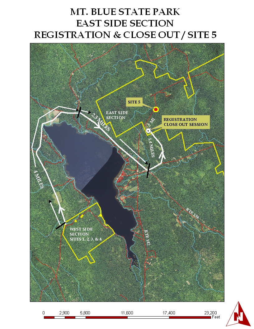
Mt. Blue State Park on Wednesday, September 3rd, 2014. Download the field workshop information,
conference Agenda, and
registration form. Thanks to all who contributed to the organization and staffing of this important workshop, especially to Dave Rocque, without whose enthusiasm and persistence this workshop would not take place. The summer 2014 issue of The Lay of the Land is now available for downloading. MAWS is hosted a workshop on August 1st, 2014: Wetland Functions & Values - 2014 Assessments and Updates. Full and Associate Member directories were updated on May 16, 2014 by Gary Fullerton, Chris Dorion, and Matt Dorman. Please verify the accuracy of your data; if further changes are needed, please email web master Chris Dorion. The winter 2014 issue of The Lay of the Land is now available for downloading. The MAPSS Annual Meeting was held on March 18th, 2014 at the Wells Conference Center at the University of Maine in Orono. Download the Agenda and the Registration form. The proposal from the MAPSS Technical Committee for adoption of the Connotative Soil Survey (CSS) and accompanying Explanation and Usage Guide was approved at the Annual Meeting of March 18th, 2014.
Please view the comparison chart for the two mapping styles for additional details. Here is a sample of an original HISS style Class B High Intensity Soil Survey and the same soil map in the Connotative Soil Survey (CSS) style. Each file is ~ 4.5 M Minimum size map units for wetland delineation: The following guidance is provided by U.S. ACOE Senior Project Manager Jay Clement. It evolved from the panel discussion at the September 4th, 2013 MAPSS field conference at Mt. Blue State Park. Jay Clement can be reached at the Maine Project Office, (207) 623-8367.
Coarse fragment descriptions in the National Soil Survey Handbook have been updated. Maine Catena Key Update (spring, 2008)
MOOSABEC soil series adopted in Maine
KNOB LOCK soil series adopted in Maine MAPSS Display Board
M.A.W.S. Annual Meeting was held on Wednesday, March 26th, 2014, at Thorne Hall, Bowdoin College, Brunswick. The Soil Science Society of Northern New England (SSSNNE) held their Annual Meeting on Thursday, February 27th, in Burlington, Vermont. The Agenda can be downloaded. Directions the Annual Meeting can be downloaded. Temporary Teaching Opportunity at Unity College I am looking for someone who might be interested in a temporary teaching opportunity at Unity College in spring 2015 for a sabbatical replacement (pending the outcome of my application). The teaching responsibilities would include an Environmental Geology course and a Weather and Climate course. Each course has a lab component to it. If you are interested or would like more information, please contact Kevin Spigel (kspigel@unity.edu). Feel free to pass this announcement along. Kevin M. Spigel, Ph.D. Associate Professor of Geoscience Co-Director of Undergraduate Research Unity College kspigel@unity.edu 207.948.9215 https://sites.google.com/a/unity.edu/kspigel/ http://www.unity.edu/academics/undergraduate_research 2013 On Thursday, September 26th, plan on attending the MASE Field Day at Pineland Farms in New Gloucester, Maine. Backhoe-dug soil pits will be available for morning inspection, followed by an afternoon discussion. October 11-13th: 3 days, 17 individual, day-long field trips, including bedrock, glacial, pedology, archaeology, and mining trips in the Katahdin region. Pre-registration is required at New England Intercollegiate Geological Conference. Download the summer 2013 edition of The Lay of the Land. Penobscot River Restoration Great Works & Veazie Dam Removals and the Sedgeunkedunk Steam Restoration. Sponsored by Ecological Landscaping Association and Society for Ecological Restoration - New England Chapter. Thursday, August 8, 2013 10:00 AM – 4:00 PM; $35.00 ELA & SER Members - $40 Non-Member. Link to the PDF flier for more information. MAWS presents a workshop Delineating Federal Wetlands Using the Northcentral/Northeast Regional Supplement, Thursday August 8th, 2013, 9:00am-3:00pm - Smiling Hill Farm, 781 County Road, Westbrook, Maine. Link to the MAWS website for more information. NHANRS & SSSNNE present a SOIL MAPPING WORKSHOP: Principles, Process & Techniques. FRIDAY AUGUST 16, 2013, 8:00am - 3:00pm, Dover, NH. Link to the PDF flier for more information.
The Janet Engle Cormier Memorial Scholarship Committee voted on March 27th, 2013 to split the $1,000 award to two deserving candidates, Aaron Englander and Cayce Salvano. UMaine-Orono plans to have an awards ceremony on Wednesday, April 17 at the University’s Fogler Library, and MAPSS President Don Phillips will hand out $500 checks to each of them at the ceremony. Following up on members' questions during Tom Peragallo's presentation at the 2013 Annual Meeting, Ruth Ladd from US ACOE gives this guidance for
using the New England
Hydric Soil Indicators ANNUAL MEETINGS SCHEDULED:
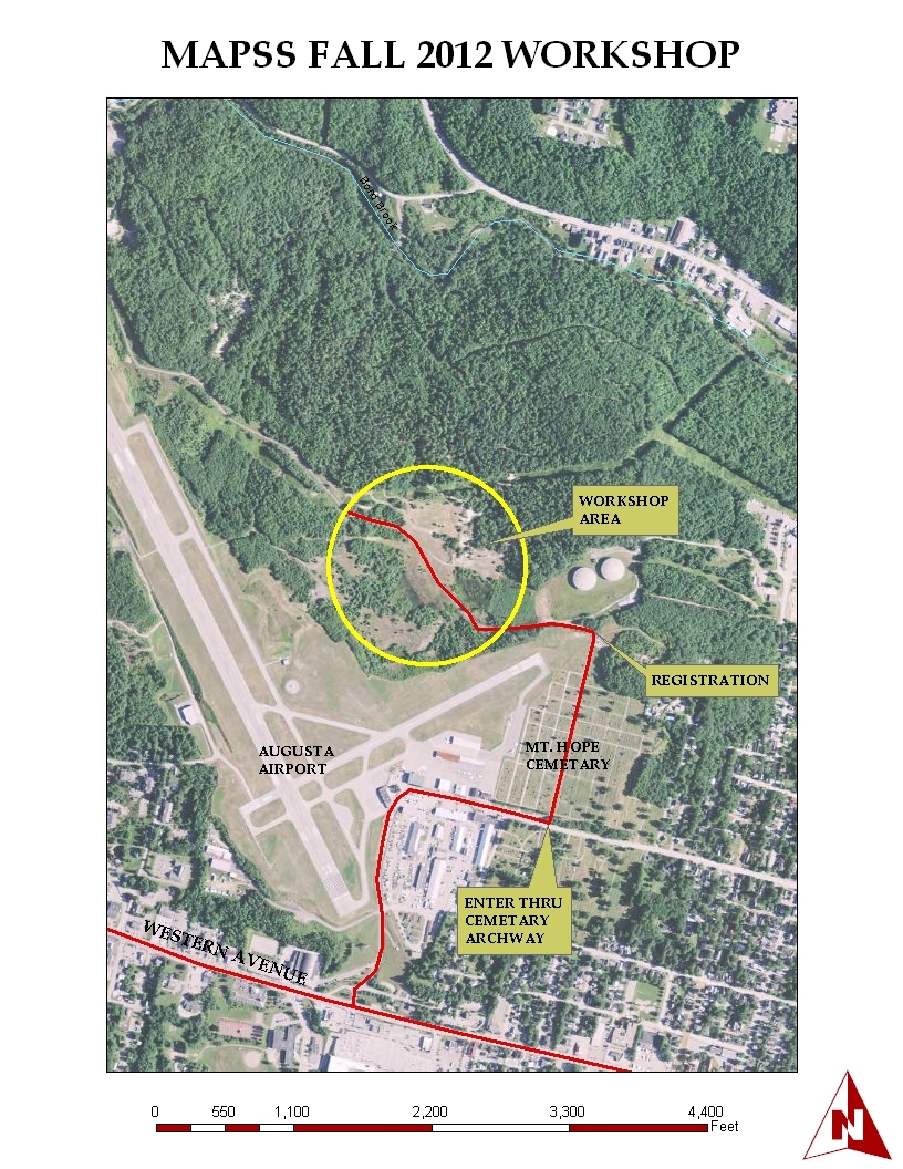
Maine Audubon and other project partners are holding several Stream Smart workshops. http://maineaudubon.org/wildlife-habitat/stream-smart/ Undergraduate and graduate students are encouraged to apply for the Janet Engle Cormier Scholarship Award. Completed applications are due March 8th, 2013. Stantec has two wetland / natural resource scientist positions open. Please use this link for further details. 2012 MAWS is hosting an afternoon workshop MAINE INLAND WADING BIRD AND WATERFOWL HABITAT WORKSHOP, to be held on Tuesday, October 2nd, from 1 to 5pm at the Augusta Elks Lodge. The annual MASE field day is scheduled for Thursday, September 27th. Please download the PDF registration and information form. The expert workshop soil pit descriptions, vegetation lists, and photos have been compiled on a separate page. Thanks to Dave Rocque, NRCS staff Nick Butler and Bob Evon for continuous pumping of pits, NRCS staff Dave Wilkinson and Greg Granger for pedon descriptions, the City of Augusta Public Works Department, MAPSS, MAWS, and MASE volunteers, the Urban Soils 2012 field workshop was a success. The 2012 MAPSS/MAWS/MASE Urban/Altered/Disturbed Soils Workshop will be held at the Augusta Bond Brook Trail System Site at the end of the Augusta Airport in Augusta, Maine on September 6, 2012 from 9:00 am until 3:00 pm. Download the registration form. This workshop is of interest to those natural resource professionals who typically encounter sites with altered soil conditions ("made land"; udorthents; filled and regraded sites), altered hydrology, and the often unusual florisitic taxa that are observed on these sites. For further description of the workshop, please download the full workshop description. The color orthophoto for the workshop location can be downloaded here. The proposed new taxonomic classification for anthropogenic soils can be downloaded here for tomorrow's workshop. The MAPSS brochure is now available. Please download the PDF preliminary version and submit comments to Johanna Szillery by October 15th, 2012. The summer, 2012 edition of The Lay of the Land is available for downloading.
Technical Tour north to the foot of Katahdin and the Golden Road in Penobscot and Piscataquis Counties, Maine. We’ll see some of the typical pedons described by NRCS soil scientists in the North Woods, such as Nicholville, Chesuncook, Monadnock, Colton, Kinsman, and Adams. NRCS soil scientists will have lab data on some of these pedons as well. We’ll cover related topics such as glacial geology, hydric soils, and elemental distributions of the major soil series in the North Woods of Maine. We are planning X-ray field exercises at sites with lab data. AGENDA8:00AM - 5:00PM Technical Field Tour Bus departs from UMaine campus for Millinocket and North Woods. 6:00PM - 8:00PM Lobster Bake at Black Bear Inn, Orono Keynote Speaker: Chris Dorion “The Glacial Geology and Soils of Baxter Park” * Bus fee, snacks, lunch and lobster banquet are included with Technical Tour registration. REGISTRATIONThe cost of the workshop is $75.00 for MAPSS/MAWS/MASE members or associate members. For planning purposes, we ask that you email Gary Fullerton or Johanna Szillery by June 11, 2012. Please see the Registration Form for more information about the tour itinerary, agenda content, and registration information.
If you wish to stay at hotels listed on the website, they are honoring lower room rates for the “Soils Conference” participants until 15 May. Changes to the MAPSS Guidelines: The Membership voted to suspend the section on Oxyaquic Conditions, pending field trials set to begin during the early summer of 2012. These field studies will evaluate the relationship between drainage class & hydrology, redoximorphic features indicative of saturation, and timing of the growing season. "SOIL WETNESS
Soil wetness refers to the duration, depth and oxidation state of a seasonal high water table [AND]. The MAPSS Annual Meeting was held on Friday, March 16th at University of Southern Maine - Portland campus. Meeting Agenda and registration form should be downloaded. The registration deadline is MARCH 7th. The MAPSS Technical Committee proposed the following changes to the MAPSS Drainage Key, which were approved by the Memberhsip at the Annual Meeting:
The full minutes of the MAPSS Technical Committee can be downloaded here. The Technical Committee is comprised of Christopher Dorion (Chair), George Bakajza, Greg Granger, Steve Howell, Tony Jenkins, Dave Marceau, Dave Rocque, Johanna Szillery, and Dave Turcotte. The MAPSS Annual Meeting program has been awarded 6 contact hours for Site Evaluators, Certified System Inspectors, and Certified System Installers. James A. Jacobsen, Project Manager, Webmaster, Division of Environmental Health, Drinking Water Program, Subsurface Wastewater Unit The January, 2012 ACOE Regional Supplement has several changes. Download the 2 page document here. The Full Member and Associate Member Directories were updated today. In order to be listed, one's membership dues for 2011 must be current. Please review for accuracy by linking to the "Directory of Members" at left and following the instructions. The FULL MEMBER and ASSOCIATE MEMBER directories are now in HTML format. Please link to them using "Directory of Members" link at left. Please scroll to your individual data cells and note any changes / additions / corrections, and then e-mail them to Chris Dorion, Webmaster. Publication of Field Indicators of Hydric Soils in the United States Version 7.0 is now available in electronic format. Download it here. 2011 AND EARLIER BAD E-MAIL ADDRESSES The 11th edition of Keys to Soil Taxonomy, as well as a summary of all changes for this new version of the Keys, are available at the NRCS website. The 2009 MAPSS Guidelines are now uploaded. Use the link at left "Publications + MAPSS Guidelines" to download the PDF files. The 2009 Executive Committee was elected at the Annual Meeting on March 10th. Use the link to the left for the new E.C. and Committee Chair list and e-mail contacts. Why soil is important: that 10 inch thick Ap horizon is all that separates us from starvation. See the review of Dirt the Movie Check out the Chesuncook soil monolith at the Smithsonian Museum of Natural History (scroll down to Image #11) in Washington, D.C. MAPSS raised over $10,000 for the monolith display. NCSS Newsletter Issue #58 can be downloaded here. Download the PowerPoint presenation Seasonal Water Table and Temperature Relationships in Calcareous Till and Residual Soils of Central Maine. Once you have downloaded the .PPT file and opened it, adjust the slide window upward, and you can read the accompanying "Notes" for each slide. MAPSS Executive Committee Meeting is scheduled for Wednesday, January 25 at 4:30pm. This will be a conference call-in meeting, largely focused on firming up the Annual Meeting Agenda, approving expenditures for the meeting, Scholarship/Education Committee update, Newsletter update, and Nominating Committee update. Please let me know if you plan to call in. As we’ll be voting/approving financial matters, Executive Committee representation is important. Thank you! Johanna Szillery, MAPSS President. Solicitation of articles for the MAPSS Newsletter. Please e-mail submissions of articles, photos, interesting soils-related work, or announcements to Amy Jones .JPEG and MS Word file types preferred. The MAWS Annual Meeting has been scheduled for Thursday, March 29th. Check the MAWS website for updates. Notice from Jay Clement, Senior Project Manager, US Army Corps of Engineers We still see some reports from some wetland scientists that use boiler plate language to the effect that "the wetlands were delineated in accordance with the 1987 Corps of Engineers Wetland Delineation Manual". The standard throughout New England is use of the '87 Manual AND the Regional Supplement. If delineators are using the supplement, they need to document it; if they are not, their delineations are not meeting standard and they face the risk of the Corps and/or the DEP rejecting the delineation. Both the manual and the supplement may be accessed off our web site. For more information please call the: Maine Project Office, (207)623-8367. November issue of the NCSS newsletter can be downloaded using Adobe Reader. The link is here. Soil Workshops - Registration deadline is January 4th for Soil Surveying, GPS, GIS, and Fundamentals in Soil Science are available here, and here and and here. MDEP and the LURC invite interested consultants to submit qualifications within the fields of sound assessment and analysis, soil suitability assessment and analysis, and erosion and sediment control plan review and assessment. The Department and LURC intend to establish a list of pre-qualified consultants to provide outside peer review services, on an as-needed basis. posted 11OCT2011 A day-long workshop focusing on: High Intensity Soil Mapping in complex, glaciated landscapes and Site Evaluator Soil Pit Classification and Wetland Delineation in pit & mound microtopography, alluvial/riverine plains, and disturbed logging areas, with the 2011 US ACOE wetland determination data forms will take place on THURSDAY, SEPTEMBER 1, 2011 [8:30 am to 3:30 pm] at the UNIVERSITY OF MAINE FOREST on the PENOBSCOT RIVER’S floodplain, terrace, marine plain, and adjacent till-mantled lowlands Sponsored by:
Download the workshop announcement. Download the Agenda and Registration forms. CEU's for New Hampshire soil and wetland scientists are now self reporting each biennial period. For more information on this new system, go to the New Hampshire Joint Board. 6 CEU hours will be granted to Maine Licensed Site Evaluators. Staff from DHHS will be present at the workshop. 6 Contact Hours will be granted to Maine Licensed Plumbing Inpsectors. Please read the position paper from MAPSS regarding LD 947, “An Act to Encourage Professionals to Move to the State” Please read the position paper from MAPSS regarding LD 904, “An Act To Make Changes to Boards and Commissions Concerning Membership, Appointments and Terms” The future of soil science in the U.S. was analyzed by staff from the Soil Science Society of America (SSSA) in a white paper that all soil scientists should take the time to carefully read. There are many insightful recommendations that MAPSS could adopt. Here's the PDF report Securing a future for soil science – A white paper The MAPSS Executive Committee will be holding a teleconference meeting on Thursday, March 31, from 4-5:15pm. For more information, please contact MAPSS President Johanna Szillery. Spring 2011 jobs announcements can be viewed here. The MAPSS Annual Meeting was be held on Wednesday, March 16th, 2011, at the Wells Conference Center, University of Maine, Orono. Download the PDF Agenda. You must pre-register by Wednesday, March 2 to reserve lunch.
NHANRS, the New Hampshire Association of Natural Resource Scientists will be holding a workshop on Thursday, March 24th titled: "Scenic and Recreational Values of Wetlands". Link to additional information here. The Maine Association of Wetland Scientists is holding its annual meeting on March 24th, 2011 at the Maple Hill Farm Conference Center, in Hallowell, Maine. SSSNNE Winter Workshop - Human Disturbed Soils: Describing and SS Mapping and ACOE Hydric Soil Updates -- Friday, February 11, 2011 -- Ashland, NH. For more information, link to: SSSNNE A recently added Google Earth hot-link enabling the spatial data set for the North Maine Woods soil survey documentation, including each soil series' Type Locality, the sampled pedon, full lab data, and soil description. The Maine Association of Wetland Scientists is holding the VERNAL POOL ROUNDTABLE DISCUSSION, PART 2, on Wednesday, December 8th, in Augusta. Download the PDF Agenda. You must RSVP by Friday, December 3rd, to Sarah Watts. The 2010 MASE / MAPSS Field Day is scheduled for Thursday, September 30th, 2010
*Full day attendance at this workshop provides 6.0 PDH’s to Licensed Site Evaluators. Driving Directions:
Heart of Maine Resource Conservation & Development announces their winter agricultural soil conference in Bangor on February 9 & 10, 2010. Use the link to access the registration materials. SSSNNE Winter Meeting & Workshop on anthropogenic and disturbed hydric soils, scheduled for Friday, February 26, 2010 in Concord. Download the registration and agenda form. 2009 WETLAND DELINEATION, IDENTIFICATION, AND SITE EVALUATOR SOIL PIT CLASSIFICATION WORKSHOP was held on September 9th, 2009
Download the field conference description and registration form.
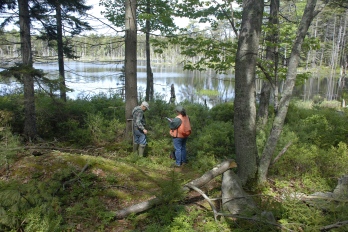
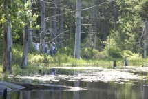
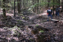
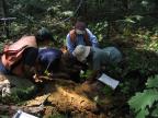
Photo on left shows a challenging forested wetland? or upland dominated by Picea rubens and Abies balsamea. Photo on right shows a challenging wetland delineation along a Great Pond. A soil scientist and botanist will be available at each transect.
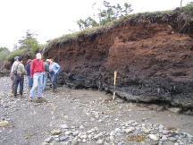
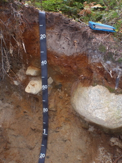
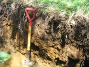
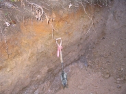
Photo on left shows glacial till with water in the soil pit. How does the Hydrology parameter match the soil morphology? Photo on right - are those redoximorphic features in the Bs horizon?
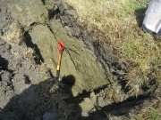
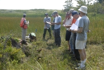
Photo on left shows a soil pit in marine sediment (Presumpscot Formation). Is this a Scantic (poorly drained) or Lamoine (somewhat poorly drained) soil? Try keying out the drainage class using both the New England Indicators and the new National Indicators. Photo on right shows the afternoon discussion session with State and Federal regulators in the pavillion. This is also the lunch area. BRING YOUR OWN LUNCH AND DRINKS. This workshop should have broad appeal to soil scientists, wetland scientists, site evaluators, code enforcement officers, planners, municipal officials, regulators, lake association members, foresters and the general public. You can participate at whatever level is appropriate for your background and knowledge of wetland delineation and septic system soil pit evaluation (the experts at each transect site will provide the level of assistance you require).
MAPSS ANNUAL MEETING WAS HELD ON Tuesday, March 10th, 2009 at the Maple Hill Farm Inn & Conference Center in Hallowell, Maine.
Please download the AGENDA and REGISTRATION FORM and return by Friday, February 27th.
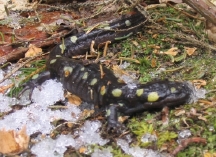
MAWS VERNAL POOL WORKSKHOP scheduled for February 6th, 2009. Download the registration information by clicking on the Ambystoma maculatum EXECUTIVE COMMITTEE MEETING scheduled for 1pm on Friday, November 21st, 2008, in Belfast. Meeting is open to MAPSS members; contact info@mapss.org for more information. Agenda to focus on planning for the 2009 MAPSS Annual Meeting, increased support for the UMaine Soil Judging Team, maintaining the relevance of soil mapping as land use ordinances change, and updating the MAPSS Guidelines for the new expedited soil surveys. UMAINE SOIL JUDGING TEAM placed 5th out of 11 universities. Photos and summary page. Read the full report by Mary Beth Parent. MASE / MAPSS Field Day is scheduled for Thursday, September 25th, 2008 Summer edition of THE LAY OF THE LAND was mailed to active members on July 24th. The PDF version will be posted in mid-August. The MAPSS membership voted in the majority at their annual meeting on March 11th, 2008, to endorse the efforts of the THE MAINE ASSOCIATION OF WETLAND SCIENTISTS to seek licensing of wetland scientists in Maine. Download the letter here. Annual Meeting Summary: Thanks to all who helped organize the meeting in 2008, and especially the speakers
PART II: NATURAL RESOURCE IDENTIFICATION AND REGULATION WORKSHOP SCHEDULED FOR 2008
Download the field conference description and registration form.
Be sure to tell the ranger at the gate that you are registering for the MAPSS workshop. Otherwise, you will be charged $4.50 per person to enter the park. Parking is limited, so PLEASE CAR-POOL to the extent practicable. Spring 2008 courses at UNH SSSNNE Annual Meeting February 22, 2008 at USM: AGENDA and REGISTRATION. Workshop February 7, 2008; Maine Association of Wetland Scientists/U.S. Army Corps of Engineers CEU REQUESTS REQUEST FOR PROFILE DESCRIPTIONS 2008, 20-23 February, National Society of Consulting Soil Scientists Annual Conference, Myrtle Beach, SC. Visit: NSCSS website. DOWNLOAD THE WINTER EDITION OF THE LAY OF THE LAND MAPSS ANNUAL MEETING SCHEDULED SMITHSONIAN FUND - CHESUNCOOK MONOLITH
WETLANDS WORKSHOP FOR FORESTERS, LOGGERS, LANDOWNERS AND CODE ENFORCEMENT OFFICERS August 16th, 2006: Hydric Sandy Soils Workshop II Spring, 2007
Summer 2007 Internships for Undergraduate Soils Students
MAWS announces its Fall training schedule for 2006. Focus on vernal pools in October.
September 22nd - 24th: Common Ground Fair September 28th, 2006: Joint MASE/MAPSS workshop
New England Intercollegiate Geological Conference, September 29th - October 1st, 2006 Collegiate SOIL JUDGING COMPETITION, October 4th-7th, 2006 UNH SOIL AND WETLAND COURSES offered for late fall 2007 and 2008. Download the PDF information here. COMMON GROUND FAIR booth, backhoe soil pits, and related information: Summer edition of The Lay of the Land will be mailed to MAPSS members in July, 2008. The on-line version will be posted 2 weeks later. August 2nd, 2007
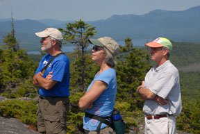
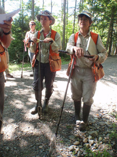
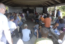
The joint MAPSS-MASE Natural Resource Identification and Regulation Workshop was held under clear blue skies at Reid State Park. Approximately 149 natural resource
specialists attended this day-long workshop. Professionals from the fields of soil science, wetland delineation and permitting, site evaluation, code enforcement, planning, and regulatory agencies participated from
9am until 3:30 pm. A series of photos with brief captions follows. Thanks to Dave Moyse, Dave Rocque, and Chris Dorion for the photos. Summary write-up and photographs April 25th, 2007
MAPSS presented the University of Maine's Soil Judging Team with embroidered field vests, caps, and bucket "Jockeys". This field equipment is to be used for their soil judging field work and Northeast competitions. October 7th, 2006
The 2006 Northeast Regional Soil Judging Competition was held on a brilliant fall day under clear blue skies. The University of Maine - Orono and the Natural Resources
Conservation Service (NRCS) organized this 3 day event.
Summary write-up and photographs September 1, 2005
The Maine Association of Site Evaluators/Maine Association of Professional Soil Scientists Training Session was be held on Thursday, September 1st on Winthrop Street in
Hallowell, just north of the Town Farm Road. The site evaluator pits were
open for review from 9 AM onward and the MAPSS training pits were open for
review from 1 PM throughout the afternoon.
Summary write-up and photographs September 21st - 22nd, 2005 MAPSS 2005 Downeast Hydric Soils Workshop
MAPSS member David Rocque compiled the report while Chris Dorion submitted annotated photos. This MAPSS workshop was made possible by prior collaboration with the New England Hydric Soil Technical Committee and NRCS Soil Scientists Dave Wilkinson and Wayne Hoar. September 16th, 2004
The Maine Association of Site Evaluators/Maine Association of Professional Soil Scientists Training Session was be held on September 16th in Corinth, Maine, ~1 mile west of Route 15 and south of Route 43. The site evaluator pits were
open for review from 9 AM onward and the MAPSS training pits were open for review from 1 PM throughout the afternoon. The site was located on and adjacent to an esker. NRCS soil mapping in this area revealed two associations of soils, based on two parent materials:
marine sediments (Swanville-Boothbay-Lyman) and glacial till (Dixmont-Thorndike-Monarda). This area is undergoing re-mapping by the NRCS, and an emerging paradigm is taking shape to account for the PARALITHIC, lime-seamed, often SAPROLITIC bedrock. |
|
© 2005 MAPSS, All rights reserved. Contact: info@mapss.org
[ Site Developed by Kenbrio ] |
